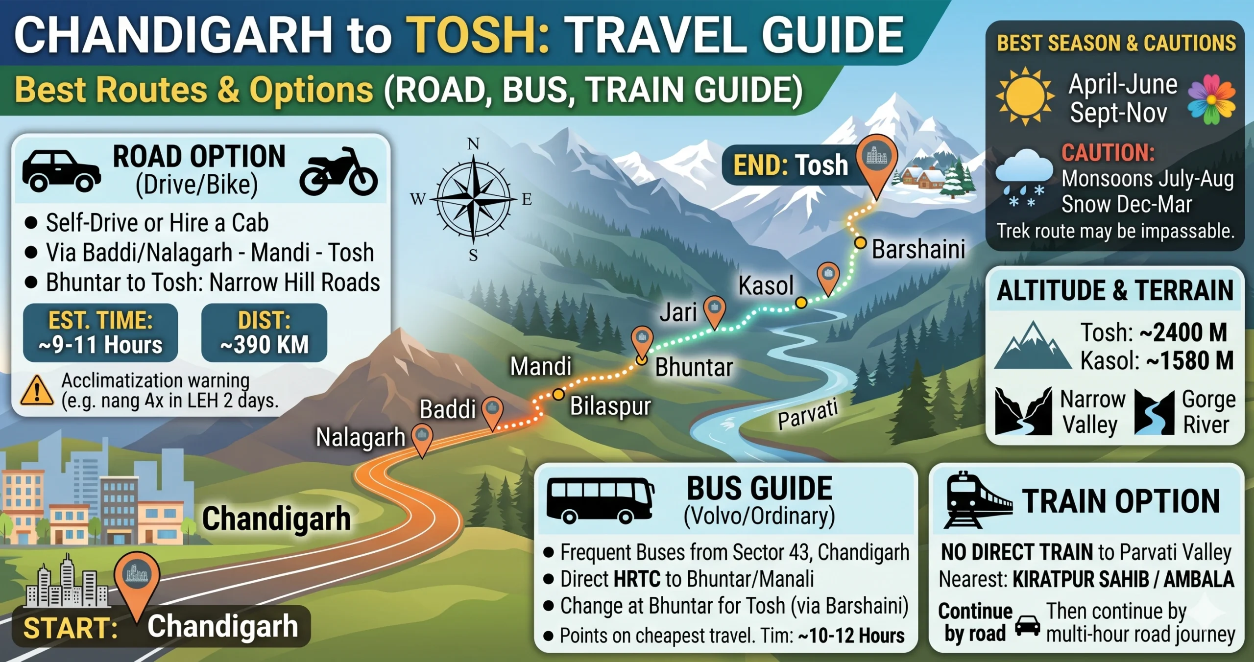
The drive from Chandigarh to Tosh is as much an experience as a means of getting somewhere — changing landscapes, winding mountain roads, and proper Himalayan scenery the whole way. Sitting at 7,874 feet in the Parvati Valley, Tosh is a small mountain village known for its rustic charm, glacier views, lively café scene, and crisp alpine air. This is where the road runs out and the mountains properly begin.
The distance is approximately 305–335 km, and the journey typically takes 9–10 hours by car or 11–13 hours by bus combo. The best seasons to visit are March–June (lush greenery) and September–November (clear mountain views).
Traveling by Road (Car/SUV)
Driving gives you full control once you enter the narrow valley roads after Bhuntar. Expect patience, tight bends, and occasional jams near Kasol.
Route 1: Via Kiratpur Tunnels & Bhuntar (Fastest & Most Popular)
Good for: The fastest access and smoother highways
Chandigarh → Ropar → Kiratpur Sahib → Bilaspur → Sundernagar → Mandi → Aut Tunnel → Bhuntar (right turn) → Jari → Kasol → Manikaran Sahib → Barshaini → Tosh
- Distance: ~305 km
- Time: 9–10 hours
You’ll cruise on a smooth four-lane highway with tunnels all the way to Mandi, followed by an easy riverside drive to Bhuntar. From Bhuntar to Barshaini, the road narrows and traffic picks up, and the final 3 km from Barshaini to Tosh is a steep, rough track.
Route 2: Via Una & Hamirpur (Scenic Backup Route)
Good for: Monsoon travel and dodging highway congestion
Chandigarh → Ropar → Anandpur Sahib → Una → Bhota → Hamirpur → Nerchowk → Mandi → Bhuntar → Kasol → Tosh
- Distance: ~335 km
- Time: 10.5–12 hours
Traffic is lighter here, the scenery greener, and it’s a genuinely useful backup if landslides or highway closures affect the main route.
The Two Roads Compared
| Route | Key Stops | Distance | Time | Verdict |
|---|---|---|---|---|
| Via Kiratpur Tunnels | Kiratpur → Mandi → Bhuntar → Kasol | ~305 km | 9–10 hrs | The fastest, using the newest highway infrastructure |
| Via Una & Hamirpur | Una → Hamirpur → Mandi → Bhuntar | ~335 km | 10.5–12 hrs | The essential backup during heavy monsoon disruption |
Estimated Cost Breakdown (For Road Travelers)
Self-Drive Fuel Cost
- Distance: 305 km
- Mileage: 12 km/L
- Petrol price: ₹110/L
- Calculation: 305 ÷ 12 × 110 = ₹2,796
Toll Estimate
- Approximately ₹200–₹300 (Kiratpur tunnels and NH highways)
Total estimated self-drive cost: ₹3,000–₹3,100
Traveling by Bus (The “Bhuntar Switch” Strategy)
No direct Volvo reaches Tosh, so you’ll need to switch rides at Bhuntar.
- Chandigarh to Bhuntar by Volvo (7 to 8 hours, ₹700–₹1,200)
- Bhuntar to Barshaini by local bus (2.5 to 3 hours, about ₹150)
- Barshaini to Tosh by shared cab or on foot (3 to 4 km, ₹300–₹400)
Start early — missing the last local bus out of Bhuntar can throw off the whole day. Book through HRTC, or via platforms such as AbhiBus and Zingbus.
Train & Air Travel
Train (Not Practical)
- Nearest rail access: Kiratpur Sahib
- Still requires an 8–9 hour road journey
Air (Fastest Option)
- Fly to Bhuntar Airport
- Taxi to Tosh: 2.5–3 hrs
Verdict
- Flights are fast but expensive and weather-dependent
- Road remains the most reliable option
Matching the Ride to the Traveler
| Mode | Approach | Time | Cost (One Way) | Good For |
|---|---|---|---|---|
| Personal SUV/car | Drive via Kiratpur & Bhuntar | 9–10 hrs | ₹3,000–₹3,100 (fuel & tolls) | Travelers with patience for narrow valley traffic |
| Bus (premium combo) | Volvo to Bhuntar + local bus/cab | 11–13 hrs | Bus (₹1,000) + cab (₹400) | An overnight trip that gets you there refreshed |
| Direct state bus | HRTC from Chandigarh to Manikaran | 12–14 hrs | ₹650–₹850 | Budget travelers, though you’ll still need a cab onward |
| Flight combo | Flight to Bhuntar + taxi | 4.5–5.5 hrs | Flight (₹5,000) + cab (₹2,000) | Anyone in a real hurry |
Things Worth Knowing Before You Set Off
- Where the road ends: Vehicles stop at the Tosh bridge. From there, it’s a 15 to 30 minute walk uphill to reach most homestays in the village.
- Pack smart: Bring a backpack rather than a trolley bag — wheeled luggage is a genuine hassle on the uphill walk.
- Fuel up in time: The last petrol pumps are in Mandi and Bhuntar — fill your tank before entering the narrow valley roads.
- Watch for traffic: Expect jams near Kasol during peak season (March–June and September–November). Leaving before 7 AM helps you beat the crowds.
- Check the weather first: Winter (December–February) can bring snowfall that blocks the last stretch, while monsoon (July–August) often brings landslides and roadblocks. Check local conditions before setting out either way.
Traveling solo? Tosh is generally a safe destination — just avoid late-night travel, stick to known homestays, and keep emergency numbers handy.
Putting It Together
- Fastest route: Via Bhuntar and the Kiratpur highway
- Best scenic backup: Via Una and Hamirpur
- Most budget-friendly: Bus, with the Bhuntar switch
- Quickest overall: Flight plus taxi
Tosh isn’t just a stop on a map — it’s where the road ends and mountain life properly begins.
Common Questions About This Trip
1. Where is Tosh located?
Tosh is a scenic village at the end of the Parvati Valley in Himachal Pradesh, sitting at an altitude of about 7,874 ft.
2. What is the distance from Chandigarh to Tosh?
The distance from Chandigarh to Tosh is approximately 305–335 km, depending on the route taken.
3. What is the best route to reach Tosh?
The most preferred route is:
Chandigarh → Kiratpur Sahib → Mandi → Bhuntar → Kasol → Tosh
4. How many hours does it take to reach Tosh?
- By car: 9–10 hours
- By bus: 11–13 hours
5. Is Tosh accessible throughout the year?
Yes, but:
- Winter (Dec–Feb): Heavy snowfall may block the last stretch
- Monsoon (Jul–Aug): Landslides and roadblocks are common
6. Can I drive my car directly to Tosh village?
No. The road ends at Barshaini and the Tosh bridge. From there, you must walk 15–30 minutes uphill to reach the village.
7. Is there a direct bus from Chandigarh to Tosh?
No direct bus. You must:
- Take a Volvo to Bhuntar
- Then a local bus to Barshaini
- Then a cab or short trek to Tosh
8. How far is Tosh from Kasol?
Kasol to Tosh is about 20 km, taking around 1–1.5 hours by road.
9. Is Tosh safe for solo travelers?
Yes, Tosh is generally safe for solo travelers. However:
- Avoid late-night travel
- Stay in known homestays
- Keep emergency contacts handy
10. What is the best time to visit Tosh?
- March–June: Pleasant weather, greenery
- September–November: Clear mountain views
- Winter: Snow experience, though with accessibility issues
11. Are there ATMs and petrol pumps in Tosh?
No. The nearest ATM and fuel are at Bhuntar, so carry enough cash and fuel.
12. Is mobile network available in Tosh?
Connectivity is limited:
- Jio and Airtel may work intermittently
- Signal is better near Kasol
13. Are hotels and cafes available in Tosh?
Yes, Tosh has:
- Budget homestays
- Guesthouses
- Popular cafes with mountain-view seating
14. Can beginners visit Tosh easily?
Yes, Tosh is beginner-friendly compared to Spiti. Just be prepared for:
- Narrow roads
- A short uphill trek
15. Is trekking required to reach Tosh?
A short trek of 15–30 minutes from the bridge is required to reach most stays in the village.
16. How far is Tosh from Manikaran?
Manikaran Sahib to Tosh is about 18–20 km.
17. Is Tosh better than Kasol?
- Kasol: Lively, more touristy
- Tosh: Quieter, scenic, peaceful
Choose based on your travel style.
18. What should I pack for Tosh?
- Warm clothes, even in summer
- Trekking shoes
- A backpack rather than a trolley bag
19. Is food easily available in Tosh?
Yes, cafes serve:
- Israeli, Indian, and Continental food
- Local Himachali dishes
20. Is Tosh suitable for family trips?
Yes, but:
- Be mindful of the short trek
- Choose comfortable stays
Explore More Parvati Valley & Himachal Travel Guides
If you’re planning to explore more of Himachal Pradesh after visiting Tosh, check out our detailed travel guides on Chandigarh to Kasol, Chandigarh to Jibhi, Chandigarh to Tirthan Valley, and Tosh to Chandigarh. Adventure seekers can also explore Malana, the Kheerganga trek, Kalga, Pulga, and Barshaini. These destination guides cover distances, best routes, transport options, road conditions, accommodation tips, and essential travel advice to help you plan a seamless Himalayan getaway.
Travel Disclaimer
The information in this guide (including routes, distances, travel times, road conditions, costs, transport options, and safety tips) is provided for general informational purposes only. While we strive to keep content accurate and up to date, road conditions, weather, public transport schedules, fares, local regulations, and service availability can change without notice. You should verify current conditions and official sources (local authorities, transport operators, weather forecasts) before you travel.
Travel and safety decisions are your responsibility. We are not liable for any loss, injury, damage, delay, or inconvenience arising from your use of this guide or from reliance on the information provided. If you have specific health, legal, or safety concerns, consult a qualified professional or local authorities prior to travel.