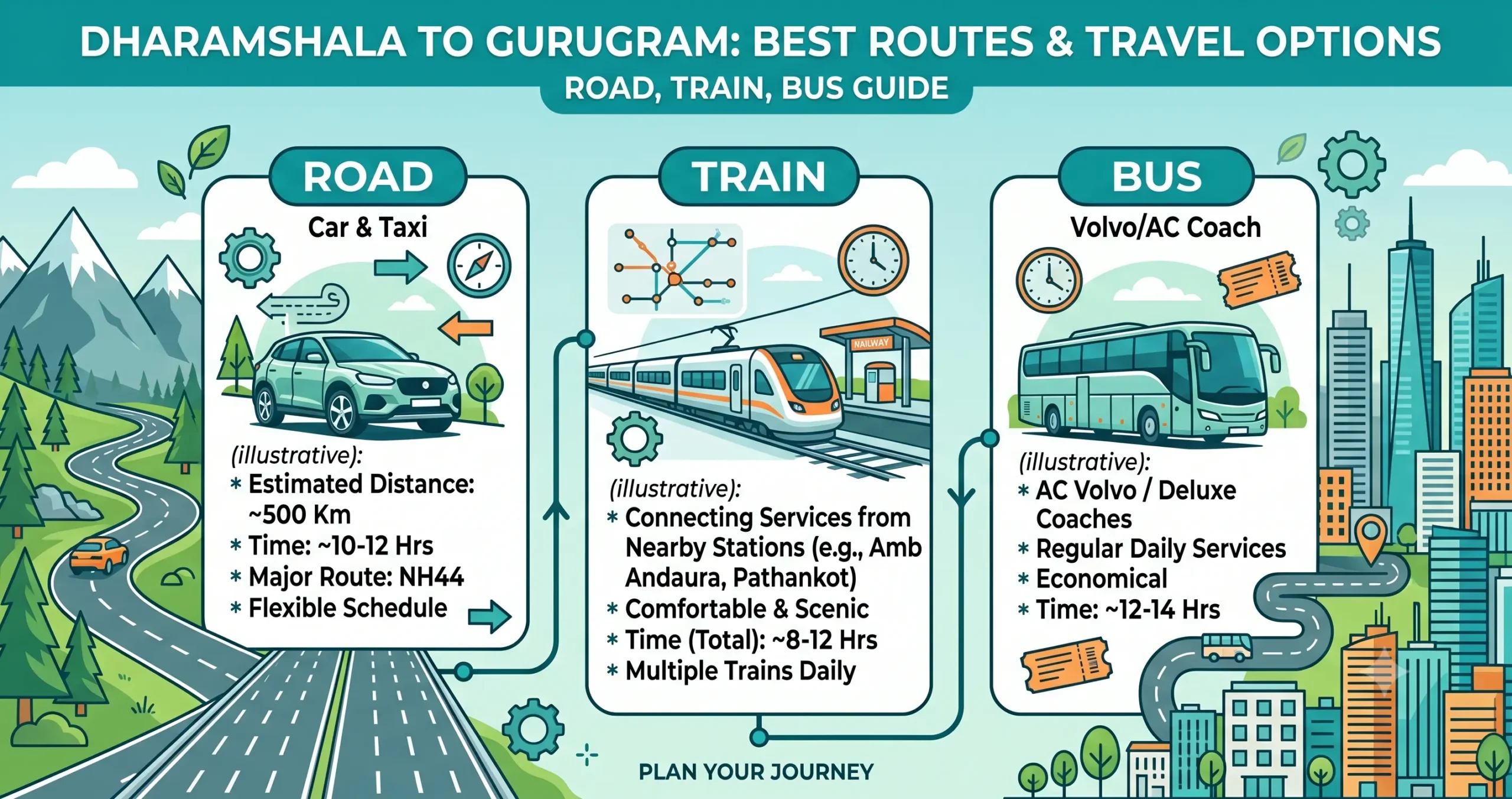
Traveling from Dharamshala to Gurugram means trading the scenic hills of Himachal Pradesh for the modern infrastructure of one of India’s biggest commercial hubs. It’s a popular route for tourists, business travelers, students, and families alike, taking in winding mountain roads, solid national highways, and modern expressways along the way.
The trip covers roughly 488 to 525 km depending on the route, and generally takes 10 to 12.5 hours by road. This guide walks through the fastest driving routes, bus services, train connections, flight options, and a few practical tips to help you plan the journey.
Trip Basics at a Glance
| Detail | Information |
|---|---|
| Starting Point | Dharamshala |
| Destination | Gurugram |
| Road Distance | 488–525 km |
| Driving Time | 10–12.5 Hours |
| Fastest Route | Via Una – Kiratpur Sahib – NH-44 – KMP Expressway |
| Best Travel Mode | Private car or Volvo bus |
| Nearest Airport | Kangra Airport (Gaggal) |
| Best Travel Season | March–June & September–November |
Driving From Dharamshala to Gurugram
Driving gives you the most flexibility, along with mountain scenery and access to some of North India’s best-known highway food stops.
Route 1: Via Una, Kiratpur Sahib & KMP Expressway (Recommended Route)
Best For
- Fastest overall travel time
- Smooth highway driving
- Avoiding Delhi traffic
- Families and business travelers
Route Map
Dharamshala → Kangra → Dehra Gopipur → Amb → Una → Kiratpur Sahib → Chandigarh Bypass (Kharar/Zirakpur) → Ambala → Karnal → Panipat → Sonipat → KMP Expressway (Western Peripheral) → Gurugram
Distance & Time
- Approximate Distance: 495–505 km
- Estimated Travel Time: 10–11.5 hours
Road Conditions
The route follows NH-503 through Kangra and Una before connecting to major highway corridors near Kiratpur Sahib. After reaching Ambala, travelers benefit from excellent road infrastructure along NH-44 and the KMP Expressway.
Verdict
This is the fastest, safest, and most efficient route to Gurugram.
Route 2: Via Hoshiarpur & Ludhiana (Doaba Route)
Best For
- Avoiding congestion near Chandigarh
- Travelers visiting Punjab’s Doaba region
- Alternative route during highway disruptions
Route Map
Dharamshala → Kangra → Chintpurni → Gagret → Hoshiarpur → Phagwara → Ludhiana → Ambala → Panipat → Gurugram
Distance & Time
- Approximate Distance: 515–525 km
- Estimated Travel Time: 11–12.5 hours
Road Conditions
This route travels through major cities in Punjab before merging with NH-44. Traffic can be heavier near Ludhiana and Phagwara during peak hours.
Verdict
A reliable backup option when the Kiratpur-Chandigarh corridor experiences delays.
Quick Route Comparison
| Route | Key Waypoints | Distance | Time | Verdict |
|---|---|---|---|---|
| Route 1 (Recommended) | Una, Kiratpur Sahib, Ambala, KMP Expressway | ~500 km | 10–11.5 hrs | Fastest, best highway infrastructure |
| Route 2 | Gagret, Hoshiarpur, Phagwara, Ludhiana | ~525 km | 11–12.5 hrs | Reliable backup when the main route is congested |
Traveling by Bus (The Overnight Volvo)
Direct luxury buses are one of the most convenient and affordable ways to make this trip.
Popular Operators
- Zingbus
- FlixBus India
- RedBus
- Abhibus
Boarding Points
Common pickup locations include:
- Dharamshala Bus Stand
- Maximus Mall Area
- Post Office Chowk
- Bharat Petrol Pump
- McLeod Ganj
Drop-Off Points in Gurugram
- IFFCO Chowk
- Rajiv Chowk
- Hero Honda Chowk
- Gurugram Bus Stand
Bus Journey Details
| Detail | Information |
|---|---|
| Travel Time | 10–12.5 Hours |
| Bus Types | AC Sleeper, Volvo, Semi-Sleeper |
| Departure | Evening & Overnight Services |
| Fare Range | ₹900–₹2,700+ |
This remains one of the most practical, budget-friendly ways to travel overnight without any driving involved.
Traveling by Train (The Smart Transit Option)
Dharamshala has no major broad-gauge railway station, so train travel here requires a road connection first.
Option 1: Via Amb Andaura Railway Station
Leg 1
Travel from Dharamshala to Amb Andaura by taxi or bus.
- Travel Time: 2.5–3 hours
Leg 2
Board premium trains such as:
- Vande Bharat Express
Leg 3
Travel from New Delhi to Gurugram via Metro or taxi.
Total Journey Time
Approximately 9–10 hours
Option 2: Via Pathankot Junction
Travel by road to Pathankot and board trains heading toward Delhi NCR before continuing to Gurugram.
Verdict
An excellent option for travelers who want to avoid long hours of highway driving.
Traveling by Air (Fastest Option)
Departure Airport
Kangra Airport
Located approximately 15 km from Dharamshala.
Arrival Airport
Indira Gandhi International Airport
Travel Process
Dharamshala → Gaggal Airport → Delhi Airport → Gurugram
Total Travel Time
Approximately 4–5 hours
Verdict
The fastest travel option, ideal for business travelers and those with tight schedules.
Good Places to Stop Along the Way
If driving, consider stopping at:
- Kangra
- Una
- Hoshiarpur
- Ludhiana
- Ambala
- Karnal
- Panipat
Comparing Every Travel Option
| Travel Mode | Strategy | Travel Time | Est. Cost | Best For |
|---|---|---|---|---|
| Personal SUV / Car | Via Una, NH-44 & KMP Expressway | 10 – 11.5 Hours | Fuel & Tolls | Families and explorers who want the freedom to stop along the way |
| Premium Bus | Direct AC Volvo (overnight) | 10h 6m – 12h 15m | ₹933 – ₹2,694+ | Comfort seekers wanting a hands-off overnight trip |
| Train Combo | Cab to Amb Andaura + Vande Bharat to Delhi | ~9 – 10 Hours Total | ₹1,500 – ₹3,000+ | Travelers who’d rather split the journey and relax on the plains |
| Flight Combo | Gaggal to Delhi + cab to Gurugram | 4 – 5 Hours Total | Premium Fares | Time-crunched travelers wanting to skip the long drive entirely |
Best Time of Year to Travel
- Spring (March–April): Pleasant temperatures, blooming landscapes, and clear mountain views — great for driving and sightseeing.
- Summer (May–June): Dharamshala stays cool, but Gurugram gets warm — an early start helps you beat the afternoon heat on the plains.
- Monsoon (July–September): Heavy rain can affect the mountain roads near Dharamshala and Kangra, sometimes causing landslides — check conditions before setting out.
- Autumn (October–November): One of the best seasons for this trip, with clear skies and comfortable temperatures throughout.
- Winter (December–February): Chilly in Dharamshala, with occasional snow at higher elevations, and morning fog that can affect visibility on the Haryana highways.
Road Conditions and Driving Tips
Most of the route runs along well-maintained highways and expressways, though the initial stretch through the Kangra Valley involves winding mountain roads that call for extra care.
- Start early to beat city traffic
- Drive cautiously on downhill sections
- Keep your FASTag active for tolls
- Avoid unnecessary overtaking in the hills
- Check tire pressure and brakes before setting off
- Watch the weather closely during monsoon and winter
Traveling Responsibly
- Avoid littering.
- Carry reusable water bottles.
- Support local restaurants and shops.
- Respect local customs and religious sites.
- Dispose of waste responsibly.
- Avoid unnecessary honking in hill towns.
Emergency Contacts
| Service | Number |
|---|---|
| National Emergency | 112 |
| Ambulance | 108 |
| Police | 100 |
| Fire | 101 |
| Highway Assistance | Available through NHAI Helpline |
It’s also worth keeping your phone charged and letting family know your travel plans.
Final Recommendation
For most travelers, the Dharamshala–Una–Kiratpur Sahib–Ambala–NH-44–KMP Expressway–Gurugram route is the strongest option, offering the shortest travel time and efficient access into Gurugram while skipping Delhi’s congestion.
If comfort is the priority, an overnight Volvo bus is a solid choice. For the fastest possible trip, a flight from Gaggal Airport to Delhi followed by a short transfer to Gurugram is hard to beat.
Frequently Asked Questions (FAQs) – Dharamshala to Gurugram Travel Guide
1. What is the distance between Dharamshala and Gurugram?
The road distance between Dharamshala and Gurugram ranges from approximately 488 km to 525 km, depending on the route selected.
2. How long does it take to travel from Dharamshala to Gurugram by road?
A continuous road journey typically takes 10 to 12.5 hours, depending on traffic, weather conditions, and the chosen route.
3. Which is the best route from Dharamshala to Gurugram?
The most recommended route is: Dharamshala → Kangra → Una → Kiratpur Sahib → Ambala → Karnal → Panipat → KMP Expressway → Gurugram. This route offers the best combination of highway infrastructure, travel time, and road conditions.
4. Is the Dharamshala to Gurugram route safe for self-driving?
Yes, the route is generally safe. Drivers should be cautious on mountain sections near Dharamshala, Kangra, and Una, particularly during monsoon and winter seasons.
5. Are there direct buses available from Dharamshala to Gurugram?
Yes, multiple operators run direct Volvo, AC Sleeper, and Semi-Sleeper buses between Dharamshala and Gurugram daily.
6. What is the average bus fare from Dharamshala to Gurugram?
Bus fares typically range between ₹900 and ₹2,700, depending on the operator, bus category, season, and booking date.
7. Is there a direct train from Dharamshala to Gurugram?
No. Dharamshala does not have a major railway station. Travelers usually reach Amb Andaura or Pathankot by road before boarding a train to Delhi NCR.
8. Which railway station is best for train travel from Dharamshala?
Amb Andaura Railway Station and Pathankot Junction are the most commonly used railway stations for onward travel toward Delhi and Gurugram.
9. What is the fastest way to reach Gurugram from Dharamshala?
The fastest option is a flight from Kangra Airport (Gaggal Airport) to Delhi, followed by a taxi or metro ride to Gurugram. The total journey usually takes around 4 to 5 hours.
10. How far is Kangra Airport from Dharamshala?
Kangra Airport is located approximately 15 km from Dharamshala and can be reached in about 25 to 30 minutes by road.
11. What is the best time to travel from Dharamshala to Gurugram?
The ideal travel periods are March to June and September to November, when weather and road conditions are generally favorable.
12. Are there toll roads between Dharamshala and Gurugram?
Yes, travelers will encounter toll plazas on major highways, especially on NH-44 and the KMP Expressway. An active FASTag is recommended.
13. Which route avoids Chandigarh traffic?
The Hoshiarpur–Phagwara–Ludhiana route can serve as an alternative if traffic around Chandigarh and Kiratpur Sahib is unusually heavy.
14. Are there enough fuel stations and restaurants on the route?
Yes, fuel stations, restaurants, food courts, and dhabas are available at regular intervals throughout Himachal Pradesh, Punjab, and Haryana.
15. Can I complete the Dharamshala to Gurugram trip in one day?
Yes, many travelers comfortably complete the journey in a single day by car, taxi, or direct bus.
16. Which travel option is best for families?
A private car or SUV offers the most flexibility for families, allowing convenient stops for meals, sightseeing, and rest breaks.
17. Which is the most economical way to travel from Dharamshala to Gurugram?
Direct Volvo and Semi-Sleeper buses are generally the most affordable option, providing comfortable travel at a reasonable cost.
18. How much fuel is required for a Dharamshala to Gurugram road trip?
Most vehicles consume approximately 35–50 liters of fuel, depending on the vehicle type, route conditions, and driving style.
19. Are hotels available for overnight stays along the route?
Yes, accommodation options are widely available in Una, Hoshiarpur, Ludhiana, Ambala, Karnal, and Chandigarh for travelers wishing to break up the journey.
20. Is the route suitable for first-time mountain drivers?
Yes, although first-time mountain drivers should drive cautiously on the Dharamshala–Kangra–Una stretch and avoid driving during heavy rain, fog, or late-night hours whenever possible.
Related Routes
- Dharamshala to Palampur
- Dharamshala to Dalhousie
- Dharamshala to Kangra
- Gurugram to Chandigarh
- Gurugram to Amritsar
- Shimla to Gurugram
Travel Disclaimer
Distances, travel durations, ticket prices, toll charges, and transportation schedules mentioned in this guide are approximate and may change due to weather conditions, road maintenance, seasonal traffic, or operational updates. Travelers are advised to verify the latest information through official transport operators and local authorities before starting their journey.