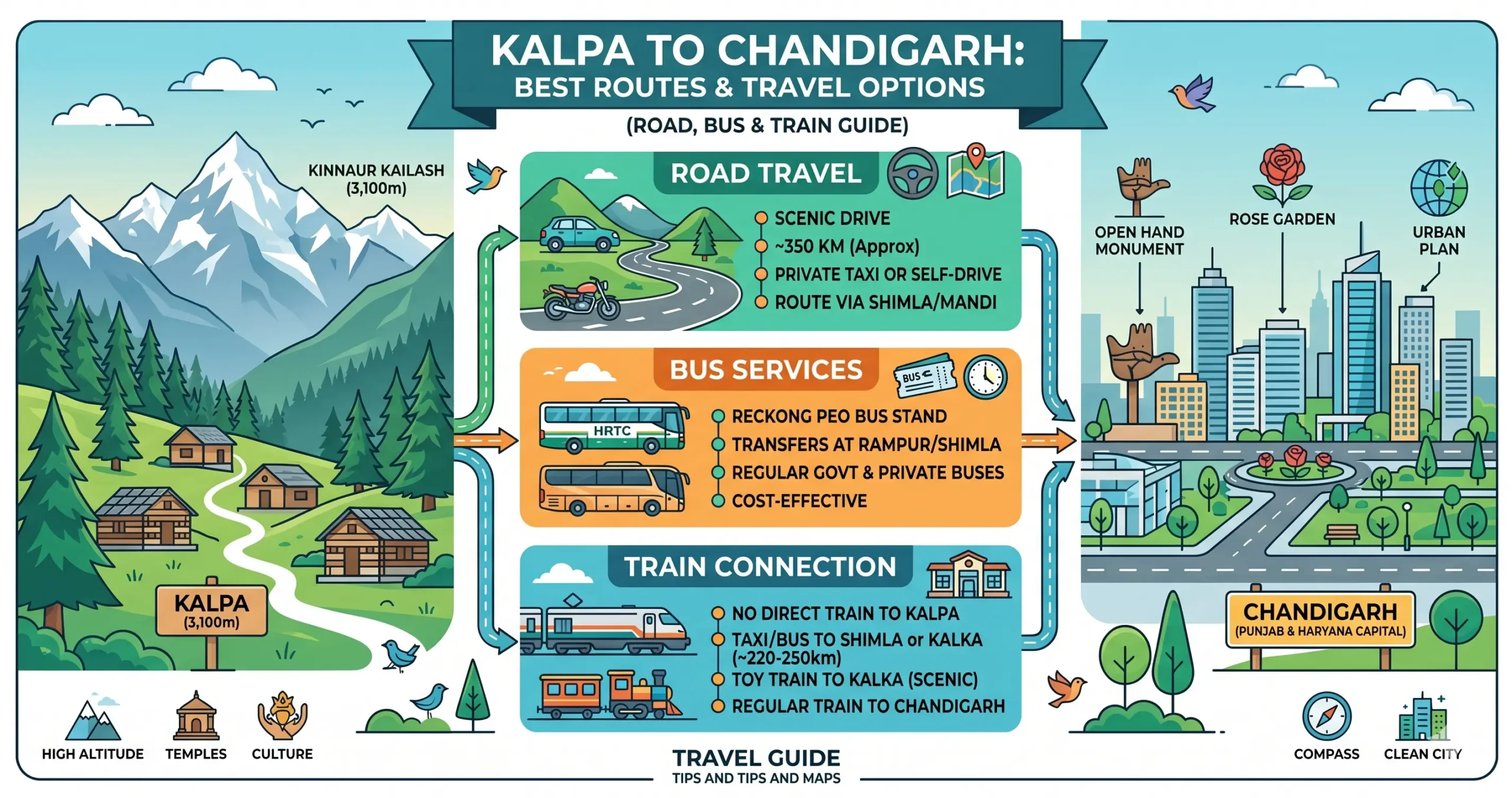
Leaving Kalpa — a quiet Himalayan village known for its apple orchards, wooden monasteries, and sweeping views of the Kinnaur Kailash range — and making your way down to Chandigarh’s organized streets is one of North India’s most striking mountain-to-plains journeys.
The road distance runs 334–360 km depending on the route, and given the winding mountain terrain, a continuous drive usually takes 9.5–12 hours. Here’s a full breakdown of your options.
Section 1: Traveling by Road (Car/SUV)
Driving from Kalpa to Chandigarh is the most flexible and rewarding way to travel. The route passes through dramatic Himalayan valleys, pine forests, apple belts, and scenic mountain highways before descending into the plains.
Route A: Via Narkanda & Shimla (Main NH5 Corridor)
Kalpa → Reckong Peo → Rampur → Narkanda → Shimla → Solan → Panchkula → Chandigarh
- Distance: about 334–348 km
- Time: 9.5–10.5 hours
What the drive looks like: you start with a short, steep descent to Reckong Peo, the administrative center of Kinnaur district. From there to Rampur, the road runs alongside the Sutlej River through rocky terrain and past hydroelectric project zones. Past Rampur, the road climbs gradually through dense pine and cedar forest toward Narkanda, one of Himachal’s more scenic hill stops. After Shimla, you merge onto the excellent Himalayan Expressway, passing Solan, Kalka, and Panchkula on the way into Chandigarh.
Taxi fares
| Vehicle | Fare |
|---|---|
| Sedan (Dzire/Etios) | ₹9,000–₹12,000 |
| SUV/Innova | ₹13,000–₹18,000 |
This is the fastest and most popular route, offering a great mix of speed and scenery.
Route B: Via Tattapani & Basantpur (Shimla Bypass Route)
Kalpa → Reckong Peo → Rampur → Kingal → Tattapani → Shoghi → Solan → Chandigarh
- Distance: about 355–360 km
- Time: 11–12 hours
Instead of climbing toward Narkanda and driving straight through central Shimla, this road diverts at Kingal and follows the Sutlej river valley toward Tattapani instead. That gives you lower-altitude driving, less tourist traffic, and a quieter, more riverside kind of scenery.
It’s especially worth taking during long holiday weekends, when Shimla congestion peaks, or if there’s snowfall near Narkanda in winter.
Route C: Via Kufri & Chail Scenic Detour
Kalpa → Rampur → Narkanda → Kufri → Chail → Kandaghat → Solan → Chandigarh
- Distance: about 365 km
- Time: 11–12.5 hours
This road takes a slightly longer path through Kufri and Chail, with dense cedar forest and some genuinely panoramic Himalayan viewpoints along the way. It’s a bit longer than the other two, but it turns the drive itself into a proper mini road trip — worth it if you’re not in a rush.
Complete Road Route Comparison
| Route Name | Key Waypoints | Approx Distance | Estimated Time | Best For |
|---|---|---|---|---|
| Route A: Via Narkanda & Shimla | Rampur → Narkanda → Shimla → Solan | 334–348 km | 9.5–10.5 hrs | Fastest & Most Popular |
| Route B: Tattapani Bypass | Rampur → Kingal → Tattapani → Shoghi | 355–360 km | 11–12 hrs | Avoiding Shimla Traffic |
| Route C: Kufri–Chail Route | Narkanda → Kufri → Chail → Solan | ~365 km | 11–12.5 hrs | Scenic Leisure Road Trip |
Section 2: Taking a Bus
Public transport is a genuinely practical, affordable way to make this trip.
Direct HRTC buses
- Departs from: mostly Reckong Peo, about 14 km from Kalpa
- Time: 10–14.5 hours
- Fare: ₹870–₹953
These run daily, are reliable, and keep transfers to a minimum — a solid choice for budget travelers.
Premium Volvo and sleeper buses
- Operators: FlixBus, Abhibus, and other private Volvo services
- Some offer a cab pickup from Kalpa itself, with boarding from Reckong Peo or Rampur
- Time: 11–13 hours
- Cost: ₹1,600–₹3,000+
Worth it if you’d like an AC semi-sleeper coach for extra comfort on the longer ride.
What About the Train?
Kalpa has no railway connectivity, given how remote it is.
Nearest Railway Stations
| Station | Distance from Kalpa | Type |
|---|---|---|
| Shimla Railway Station | ~260 km | Narrow-gauge |
| Kalka Railway Station | ~330 km | Broad-gauge |
| Chandigarh Railway Station | Final destination | Major rail hub |
Is the toy train worth it?
The Kalka–Shimla Railway is a wonderful sightseeing experience, but not a practical way to actually get from Kalpa to Chandigarh — reaching Shimla itself takes a long road journey, and you’d need multiple transfers, stretching the trip out considerably. Road transport remains the more sensible choice here.
What About Flying?
Kalpa has no airport of its own.
| Airport | Distance | Connectivity |
|---|---|---|
| Jubbarhatti Airport (Shimla) | ~267 km | Limited regional flights |
| Chandigarh International Airport | ~350 km | Major domestic hub |
Since flights to Shimla are limited and weather-dependent, most travelers stick with road transport for this route.
Comparing All Your Travel Options
| Mode | How it works | Time | Cost | Best for |
|---|---|---|---|---|
| Self-drive car/SUV | Via NH5 & Shimla | 9.5–10.5 hrs | Fuel, ₹3,500–₹5,000 | Families and groups |
| Private taxi | Direct cab from Kalpa | ~10.5 hrs | ₹9,000–₹18,000 | Comfortable travel |
| Direct HRTC bus | From Reckong Peo | 10–14.5 hrs | ₹870–₹953 | Budget travelers |
| Premium Volvo combo | Cab pickup + AC bus | 11–13 hrs | ₹1,600–₹3,000+ | Solo travelers |
| Train combination | Road + toy train | 16–20 hrs | Variable | Just for the scenic experience |
Choosing the Best Time to Travel
- March to June: pleasant temperatures, clear roads, excellent mountain views
- September to November: crisp weather, lush post-monsoon greenery, great for photography
- December to February: snowfall possible near Narkanda and upper Kinnaur, with occasional road closures
- July to August: monsoon season, with a higher risk of landslides — travel with extra caution
Good Places to Stop Along the Way
| Location | Known For |
|---|---|
| Reckong Peo | Kinnaur district headquarters |
| Rampur Bushahr | A town along the Sutlej river valley |
| Narkanda | Apple orchards and mountain views |
| Shimla | Its colonial hill-station character |
| Tattapani | Hot springs and riverside scenery |
Mobile Network & Internet Connectivity
Mobile coverage improves significantly as you move toward Chandigarh.
Generally Reliable
- Jio
- Airtel
- BSNL
Possible Issues
- Network interruptions in remote Kinnaur stretches
- Slower internet speeds in some mountain sections
Downloading offline maps before departure is highly recommended.
A Few Things Worth Planning For
- Arrange local transport early — most buses depart from Reckong Peo, not Kalpa itself, so book a taxi or local bus in advance for that 14 km connection
- Check weather and road conditions before you leave, especially for landslide risk near Reckong Peo–Rampur during monsoon, or snowfall near Narkanda in winter
- Start before 7 AM to avoid driving the mountain sections in darkness
- Carry cash — ATMs are limited in Kalpa, Reckong Peo, and Rampur
- Pack warm clothing regardless of season, since temperatures drop fast at higher elevations
- Download offline maps ahead of time, given the patchy network in remote stretches
- Get your vehicle checked — brakes, tires, and engine — before setting off on the mountain roads
- Fuel up in advance at Reckong Peo, Powari, Rampur, Narkanda, Shimla, or Solan — there’s no fuel available between Kalpa and Reckong Peo
Final Verdict
For most travelers, the NH5 route via Narkanda and Shimla remains the best combination of speed, scenery, and road quality.
Choose:
- Route A for the fastest and most reliable journey
- Route B to avoid Shimla congestion
- Route C for a scenic Himachal road trip experience
If you are traveling on a budget, direct HRTC buses from Reckong Peo are highly economical. For extra comfort, premium Volvo and semi-sleeper buses provide a more relaxed overnight journey.
No matter which route you choose, the drive from the serene Himalayan landscapes of Kalpa to the organized cityscape of Chandigarh is an unforgettable mountain travel experience.
Frequently Asked Questions (FAQs) – Kalpa to Chandigarh Travel Guide
1. What is the distance between Kalpa and Chandigarh?
The road distance between Kalpa and Chandigarh ranges from approximately 334 km to 360 km, depending on the route selected.
2. How long does it take to travel from Kalpa to Chandigarh by road?
A continuous road journey by car or taxi usually takes around 9.5 to 12 hours, depending on weather, traffic, and road conditions.
3. Which is the best road route from Kalpa to Chandigarh?
The most preferred route is:
Kalpa → Reckong Peo → Rampur Bushahr → Narkanda → Shimla → Solan → Chandigarh
This NH5 corridor offers the best combination of scenery, road quality, and travel speed.
4. Is the Kalpa to Chandigarh road safe for self-driving?
Yes, the route is generally safe for experienced drivers. However, certain stretches in Kinnaur district feature narrow cliffside roads, sharp bends, and occasional landslide zones, so careful driving is essential.
5. Are there direct buses from Kalpa to Chandigarh?
Most buses operate from nearby Reckong Peo, which is about 14 km from Kalpa. Direct and semi-direct services to Chandigarh are available through HRTC and private operators.
6. What is the bus fare from Kalpa to Chandigarh?
HRTC bus fares generally range from ₹870 to ₹953, while premium Volvo and semi-sleeper buses may cost between ₹1,600 and ₹3,000+.
7. Can I get Volvo or luxury buses from Kalpa?
Yes, private operators like FlixBus and Abhibus offer premium AC semi-sleeper and Volvo-style services, usually boarding from Reckong Peo or Rampur.
8. What is the cheapest way to travel from Kalpa to Chandigarh?
The cheapest option is the HRTC state transport bus service departing from Reckong Peo.
9. Is there a train from Kalpa to Chandigarh?
No, Kalpa does not have railway connectivity. The nearest railway stations are in Shimla and Kalka.
10. Is the Kalka–Shimla toy train practical for this journey?
The Kalka–Shimla Railway is excellent for sightseeing but not ideal for quick travel because reaching Shimla itself requires several hours of road travel.
11. Which is the nearest airport to Kalpa?
The nearest airport is Jubbarhatti Airport near Shimla, though connectivity is limited. Most travelers rely on Chandigarh International Airport for major flights.
12. Which route avoids Shimla traffic while traveling to Chandigarh?
The Tattapani–Basantpur bypass route helps travelers avoid Shimla city congestion and offers a quieter riverside drive.
13. Are fuel stations available on the route?
Yes, fuel stations are available at:
- Reckong Peo
- Powari
- Rampur Bushahr
- Narkanda
- Shimla
- Solan
14. What is the best season to travel from Kalpa to Chandigarh?
The best travel seasons are:
- March to June for pleasant weather
- September to November for clear Himalayan views
Winter months may bring snowfall in upper Himachal regions.
15. Are there landslide-prone areas on the Kalpa route?
Yes, some sections of NH5 in Kinnaur district are prone to landslides during monsoon season, especially between Reckong Peo and Rampur. Always check weather and road conditions before departure.
Distances, travel times, and fares mentioned here are approximate and can shift due to weather, traffic, or transport schedule changes. It’s worth confirming the latest details with official sources like HRTC and real-time navigation apps before you travel.