The road journey from Mandi to Kullu is one of the most important travel corridors in Himachal Pradesh, connecting tourists to Manali, Kullu Valley, and Lahaul. Under normal conditions, travelers use NH 3 (Mandi–Pandoh–Aut–Bajoura).
However, this highway is highly vulnerable to landslides and traffic jams, especially near Pandoh Dam, 6 Mile, 9 Mile, and the Aut Tunnel. During monsoon or peak tourist season, long closures are common.
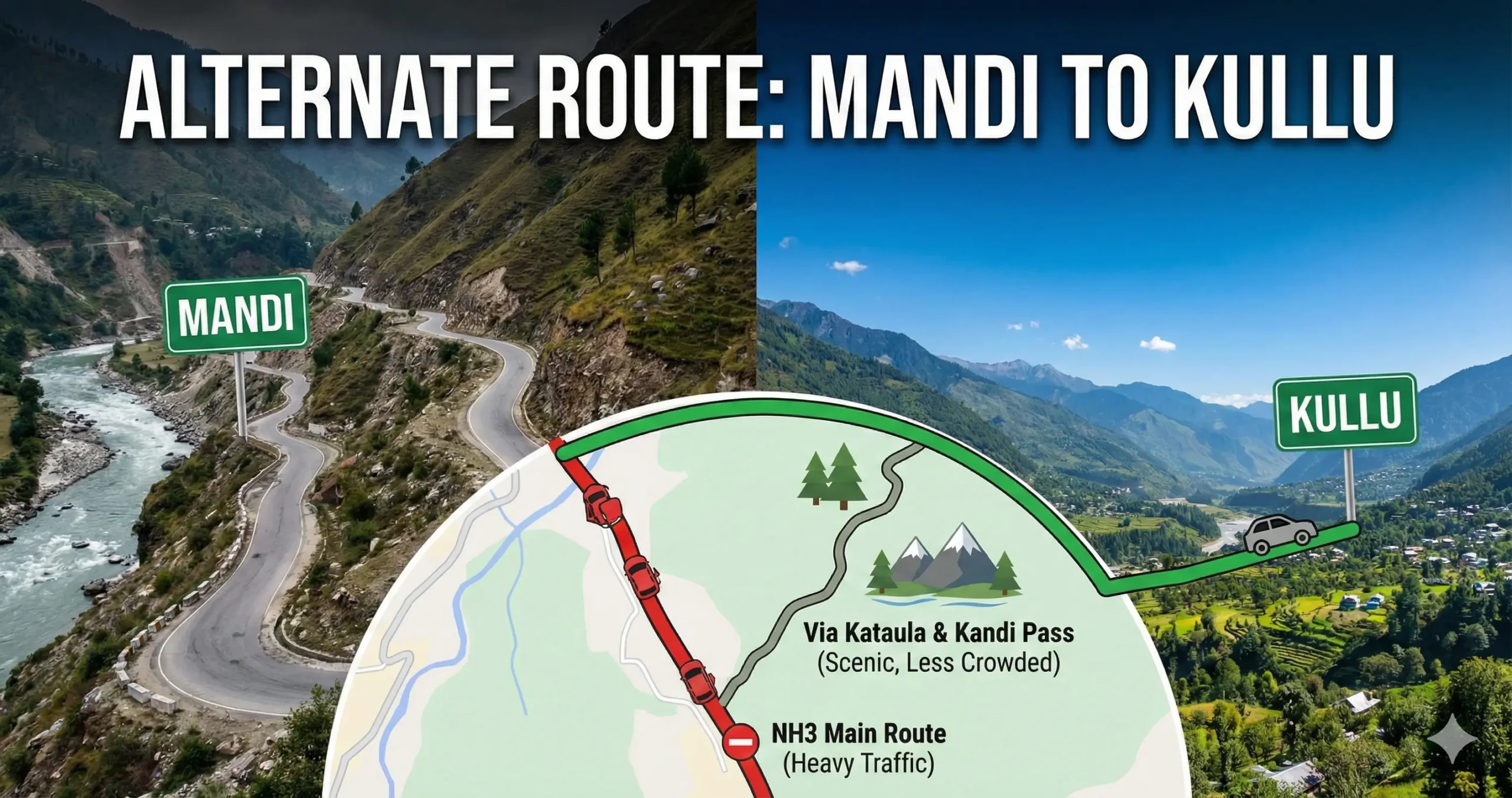
When NH 3 is blocked, there is only one practical alternate route for light vehicles.
The Only Alternate Route from Mandi to Kullu (Via Kataula – Kandi Pass)
Route
Mandi → Kamand (IIT Mandi) → Kataula → Kandi Pass → Bajoura → Kullu
This interior mountain road runs on the left bank of the Beas River and completely bypasses Pandoh Dam and the Aut Tunnel, reconnecting with NH 3 directly inside the Kullu Valley.
Why This Route Is Used
- Avoids landslide-prone Pandoh stretch
- Bypasses the Aut Tunnel bottleneck
- Directly enters Kullu Valley at Bajoura
- Only option when NH 3 is fully closed
Distance, Time & Road Conditions
- Distance: ~60–65 km
- Travel Time: 2.5–3.5 hours
- Road Type: Fully paved but single-lane
- Gradient: Very steep near Kandi Pass
- Traffic: Light vehicles only
⚠️ Passing oncoming vehicles often requires stopping or reversing.
Who Should Use the Kataula Route?
| Suitable For | Not Suitable For |
|---|---|
| Cars & SUVs | Buses |
| Bikes | Trucks |
| Experienced hill drivers | New hill drivers |
| Emergency detours | Night driving |
Comparison: Main Highway vs. Kataula Route
| Feature | Main NH 3 (via Pandoh) | Alternate (via Kataula) |
| Route | Mandi → Pandoh → Aut → Bajoura | Mandi → IIT → Kataula → Bajoura |
| Traffic | Heavy Trucks & Volvos | Light Vehicles Only |
| Risk | Landslides at 6 Mile/Pandoh | Steep Gradients & Narrow Turns |
| Scenery | River View & Tunnel | Dense Forest & Mountain Top |
| Amenities | Many Dhabas & Mechanics | Very Few (Carry Snacks) |
Important Travel Advisory
- ❌ Heavy vehicles are banned on the Kataula route
- 🛣️ Expect sharp hairpin bends and steep climbs
- 🌧️ Avoid during extreme rainfall without confirmation
- ⛽ Fuel up in Mandi (no pumps till Bajoura)
- 🍴 Carry food and water
When Should You Take the Alternate Route?
If traffic is stopped at Bindravani (Mandi outskirts) or authorities announce NH 3 closure due to landslides, immediately divert via Victoria Bridge → Kamand → Kataula.
Conclusion
The Kataula–Kandi Pass route is the only alternate route from Mandi to Kullu when NH 3 is blocked. While challenging, it can save several hours—or even an entire day—if used carefully and at the right time.
Frequently Asked Questions (FAQs)
1. What is the alternate route from Mandi to Kullu?
The only alternate route is Mandi → Kamand (IIT Mandi) → Kataula → Kandi Pass → Bajoura → Kullu. This route bypasses Pandoh Dam and the Aut Tunnel.
2. When should I use the Kataula alternate route?
Use this route when NH 3 is blocked due to landslides, heavy rain, or traffic jams near Pandoh, 6 Mile, 9 Mile, or Aut Tunnel.
3. Is the Kataula route safe for cars?
Yes, it is safe for cars and SUVs driven by experienced hill drivers. The road is narrow and steep, especially near Kandi Pass.
4. Can buses or trucks use the alternate route?
No. Heavy vehicles are not allowed on the Kataula route due to sharp curves and narrow road width. It is strictly for light motor vehicles (LMVs).
5. How much time does the alternate route take?
The Kataula route usually takes 2.5 to 3.5 hours, depending on traffic and road conditions.
6. Is the Kataula route open during monsoon?
The route may remain open during light rain, but it can close during heavy monsoon due to landslides. Always check local updates from Mandi Police before taking this road.
7. Are petrol pumps or food stops available on this route?
No. There are no petrol pumps or major food stops between Mandi and Bajoura. Fuel up and carry food before starting.
8. Is night driving recommended on the Kataula route?
No. Night driving is not recommended due to steep gradients, blind curves, and lack of lighting.
9. Does Google Maps show the Kataula alternate route?
Sometimes. Google Maps may suggest it during highway closures, but it’s safer to manually add waypoints like Kamand or Kataula.
10. Is this route suitable for first-time hill drivers?
No. First-time hill drivers should avoid this route unless absolutely necessary, as frequent reversing and tight turns are required.