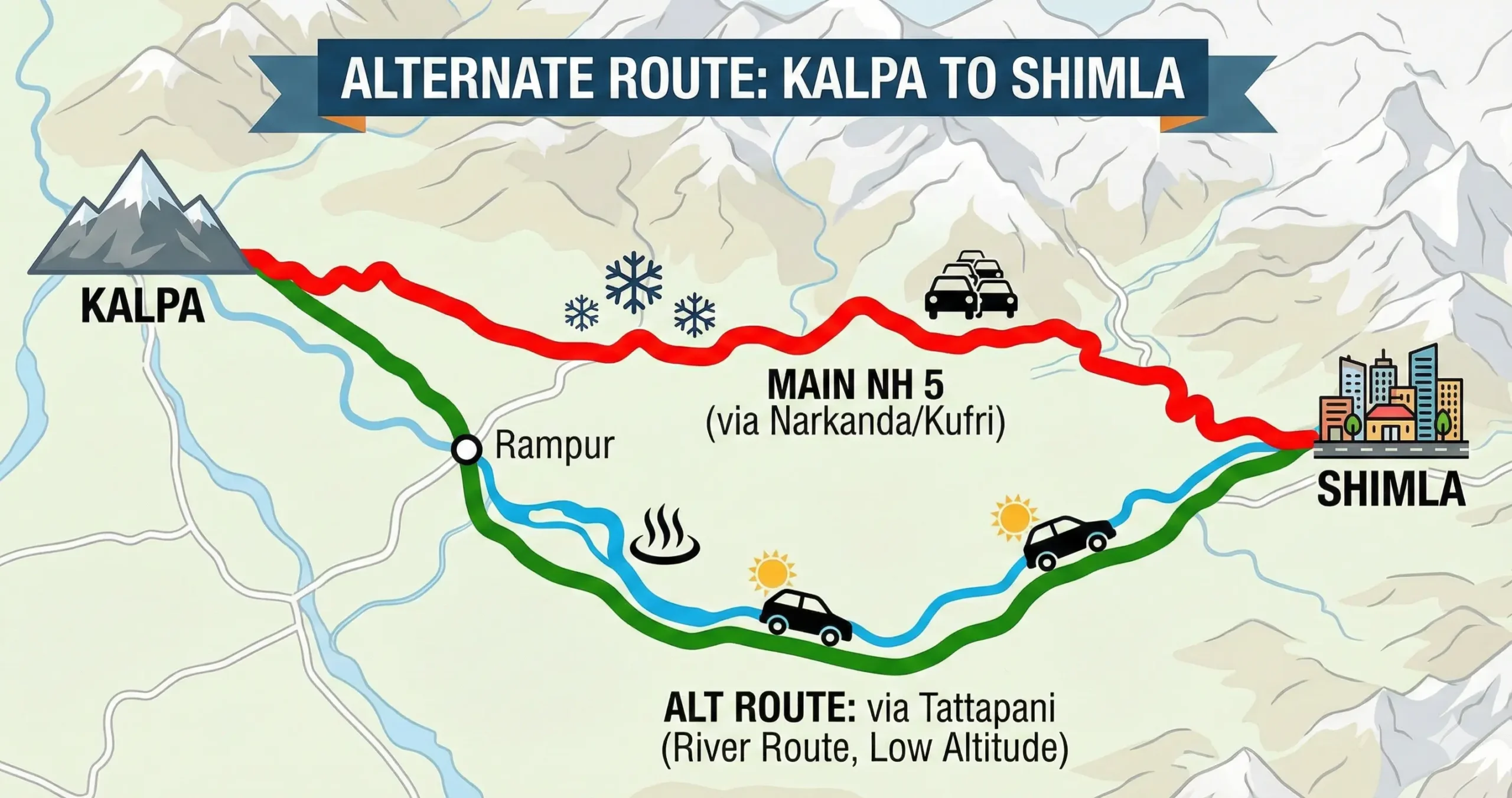
Kalpa (Kinnaur) to Shimla is one of Himachal Pradesh’s most scenic yet challenging road journeys. While the standard route via NH 5 (Hindustan–Tibet Highway) is famous and generally reliable, it often becomes problematic due to snowfall at Narkanda in winter and tourist congestion at Kufri and Dhalli in summer.
If you’re searching for the best alternate route from Kalpa to Shimla, here are the most practical and commonly used options—especially useful during snow, traffic jams, or road closures.
Main Route (For Reference)
Kalpa → Rampur → Narkanda → Theog → Kufri → Shimla (NH 5)
- Distance: ~225 km
- Travel Time: 7–9 hours
- Issues: Snow at Narkanda (winter), tourist jams at Kufri & Dhalli
This is the fastest route in clear weather but not always the safest or smoothest.
The Tattapani River Route: The Winter Bypass
Route
Kalpa → Rampur → Kingal → Basantpur → Sunni → Tattapani → Mashobra → Shimla
Why This Is the Best Alternate Route
This route avoids the high-altitude Narkanda Pass entirely by descending toward the Sutlej river valley, making it the most reliable winter bypass from Kinnaur to Shimla.
Key Highlights
- Stays at lower altitude (minimal snow risk)
- Avoids Kufri & Dhalli congestion
- Scenic river-side drive
- Passes the famous Tattapani hot springs
Road Conditions
- Mostly paved, single-lane in sections
- Narrow in parts between Kingal and Sunni
- Suitable for cars & SUVs
- Drive cautiously during monsoon due to falling stones
Distance & Time
- Distance: ~240 km
- Time: Similar or slightly longer than NH 5, but far more predictable in winter
This is the route to take between December and February, when Narkanda is at real risk of being snowed in.
The Mashobra–Bekhalti Bypass for Entering Shimla
Theog → Bekhalti → Mashobra → Shimla
When to Use This Route
If NH 5 is open but Shimla entry traffic is jammed, this short bypass helps you avoid Kufri, Fagu, and Dhalli Tunnel bottlenecks.
Advantages
- Saves 1 hour or more during peak tourist season
- Quiet forest road
- Smooth entry into Shimla via Sanjauli bypass
Keep in mind this only helps with the last leg of the trip — you’d still take the main route or the Tattapani route to get most of the way there first.
Which Alternate Route Should You Choose?
| Route | Path | Best for | Winter status |
|---|---|---|---|
| Main NH 5 | Rampur → Narkanda → Kufri | Speed and amenities | Often closed due to snow |
| Via Tattapani | Rampur → Kingal → Sunni → Shimla | Avoiding snow and Kufri traffic | Open and safe |
| Via Bekhalti | Theog → Bekhalti → Mashobra | Bypassing city traffic | Open |
Travel Tips for Kalpa–Shimla Drive
- Cross the Tapri–Choling stretch in daylight. This section is known for occasional falling stones, so it’s best driven when visibility is good.
- Fuel up at Tapri or Rampur. Fuel stations get scarce further along, especially on the Tattapani route.
- Carry snacks on the Tattapani route. Food options are limited — a few small dhabas near Sunni and Tattapani, but not much else.
- Expect warmer weather on the river route. The lower altitude means noticeably milder temperatures compared to Narkanda.
- Avoid night driving if you’re not familiar with these roads. Both alternate routes have narrow sections and sharp curves that are harder to manage safely after dark.
The Route That Beats the Snow
The best alternate route from Kalpa to Shimla is clearly the Rampur–Kingal–Sunni–Tattapani–Mashobra route, especially during winter and peak tourist seasons. It’s safer, less crowded, and far more predictable than battling snow or traffic on NH 5.
Common Questions About This Route
1. What is the best alternate route from Kalpa to Shimla?
The best alternate route is Kalpa → Rampur → Kingal → Basantpur → Sunni → Tattapani → Mashobra → Shimla. This route avoids the snow-prone Narkanda pass and heavy traffic at Kufri.
2. Is the Tattapani route safe during winter?
Yes. The Tattapani route stays at a lower altitude and usually remains open and snow-free, making it the safest option from December to February.
3. How much longer is the alternate route via Tattapani?
The Tattapani route is around 10–15 km longer than the main NH 5 route, but travel time is often similar or even shorter when Narkanda or Kufri is congested.
4. Can small cars use the Kalpa–Tattapani–Shimla route?
Yes, cars and SUVs can use this route. However, drive cautiously on narrow sections between Kingal and Sunni, especially after rainfall.
5. Which route should I avoid during heavy snowfall?
Avoid the Rampur–Narkanda–Theog stretch during heavy snowfall, as Narkanda Pass often gets closed. Use the Tattapani route instead.
6. Is there an alternate route to avoid Kufri traffic while entering Shimla?
Yes. You can take Theog → Bekhalti → Mashobra → Shimla, which bypasses Kufri, Fagu, and the Dhalli Tunnel congestion.
7. Are fuel stations available on the alternate route?
Fuel stations are available at Tapri and Rampur. On the Tattapani route, fuel pumps are limited until Sunni, so refuel early.
8. Are food stops available on the Tattapani route?
Food options are limited. Small dhabas are available near Sunni and Tattapani, but it’s best to carry snacks and water.
9. Is night driving recommended on alternate routes from Kalpa to Shimla?
Night driving is not recommended, especially on the Tattapani route, due to narrow roads, sharp curves, and limited lighting.
10. Does Google Maps suggest the Tattapani alternate route automatically?
Not always. Google Maps may still route you via Narkanda. It’s best to manually set waypoints like Kingal, Sunni, or Tattapani.
Travel Information Disclaimer
The travel information provided on this page is for general informational purposes only and may change without notice. Road conditions, travel times, fares, weather, transport availability, fuel access, and local regulations can vary due to traffic, maintenance, landslides, snowfall, or other unexpected events, so travelers should verify current details before departure. The publisher is not responsible for delays, losses, injuries, damages, or other issues arising from reliance on this information. Travel at your own risk and use appropriate caution, especially in mountain or remote areas.