Traveling from the cold desert landscapes of Spiti Valley to the dramatic river gorges of Kinnaur is one of Himachal Pradesh’s most spectacular road journeys.
Most travelers drive from Kaza (Spiti’s headquarters) to Reckong Peo or Kalpa in Kinnaur — a distance of approximately 200 km.
But many visitors ask: Is there any alternative route from Spiti Valley to Kinnaur?
Here is the complete breakdown of your journey and the only real “alternates” available.
NH-505: The Only Road That Connects Them
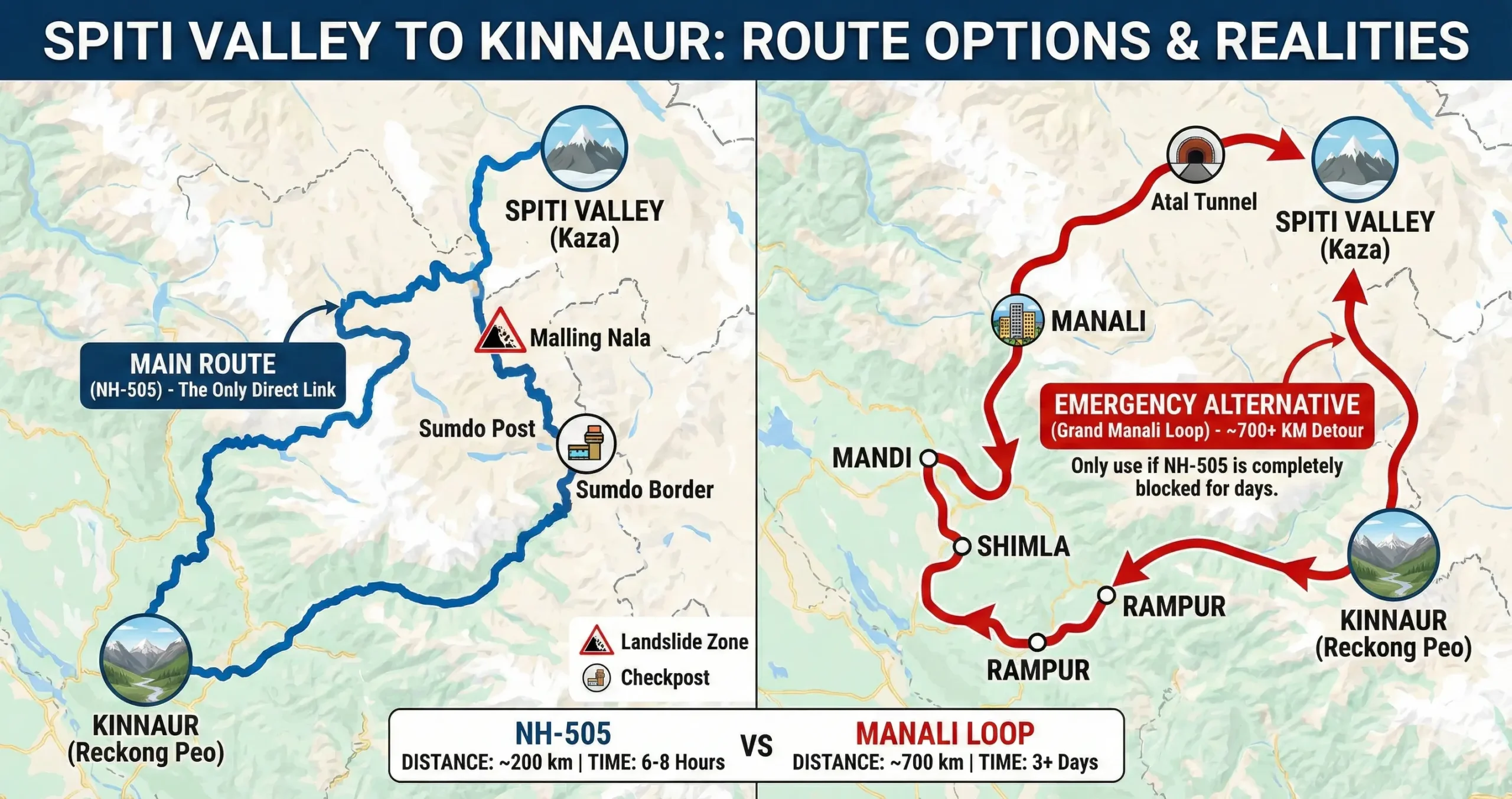
Spiti and Kinnaur are joined by one highway: NH-505, also called the Hindustan-Tibet Highway. It is cut into the cliffside and follows the Spiti River until it meets the Sutlej River.
The route: Kaza → Tabo → Sumdo → Nako → Pooh → Reckong Peo
- Distance: about 200 km
- Time: 6–8 hours, depending on the road
The Drive, Step by Step
- Kaza to Tabo (48 km): An easy drive through the valley, past monasteries, with open views.
- Tabo to Sumdo (28 km): This is where you reach the Sumdo checkpost, the entry point into Kinnaur.
- Sumdo to Nako (35 km): The hardest part. You’ll cross Malling Nala, a spot known for landslides.
- Nako to Reckong Peo (100 km): The road drops through the Sutlej gorge, passing Pooh and Spello.
What If the Road Is Blocked?
If landslides shut down the Sumdo–Nako section, there is no easy way around it. Your only choice is a full detour across the state.
The Backup Route: Manali and Shimla
This is not a shortcut. It’s a completely different journey.
The route: Kaza → Kunzum Pass → Atal Tunnel → Manali → Mandi → Shimla → Narkanda → Rampur → Kinnaur
- Distance: 700+ km
- Time: at least 2–3 days
- Season: only open June to October, when Kunzum Pass is open
You would leave Spiti through Lahaul, go down into Kullu Valley, then drive back up to Kinnaur through Shimla. In winter, if NH-505 closes, Spiti gets cut off until it reopens.
Side Trips Worth Taking
There’s no other main road, but a few detours are worth the time.
Pin Valley: Turn off at Attargo Bridge toward Mudh village, inside Pin Valley National Park. You’ll need to come back to rejoin NH-505.
Dhankar Monastery: A short climb to a 1,000-year-old monastery on a cliff, with views of where the Spiti and Pin rivers meet.
Gue Mummy Village: A small detour past Sumdo to see a naturally preserved monk mummy, said to be about 500 years old.
Routes at a Glance
| Route | Distance | What It Is | Best For |
|---|---|---|---|
| NH-505 (main route) | ~200 km | The only direct road | Normal travel |
| Manali–Shimla loop | ~700 km | Backup route only | When the main road is closed |
| Pin Valley detour | +60 km round trip | Scenic side trip | Photos, nature |
Before You Leave
- Check on Malling Nala. Ask in Kaza or Tabo before you go. This spot can close without much warning.
- Fill up in Kaza. Fuel stations become rare after this point.
- Check the weather. Conditions can change fast, especially near water crossings and loose rock.
What This Means for Your Trip
There is no real alternate route between Spiti and Kinnaur.
- NH-505 is the only direct connection.
- If blocked, the Manali–Shimla loop is the only viable (but lengthy) alternative.
- Otherwise, waiting for road clearance is often the safest choice.
Questions Travellers Ask
1. Is there any direct alternative route from Spiti Valley to Kinnaur?
No. The only direct road connecting Spiti Valley and Kinnaur is NH-505. There is no parallel highway or shortcut.
2. What is the main road from Kaza to Reckong Peo?
The main route is NH-505: Kaza → Tabo → Sumdo → Nako → Pooh → Reckong Peo.
3. What happens if NH-505 is closed due to landslides?
If the Sumdo–Nako stretch is blocked, travelers must take the long Manali–Shimla loop, which is approximately 700+ km and takes 2–3 days.
4. Is the Manali route available throughout the year?
No. The route via Kunzum Pass is generally open only from June to October. In winter, heavy snowfall can isolate Spiti completely.
5. How long does it take to travel from Spiti to Kinnaur?
Under normal conditions, the 200 km journey takes 6–8 hours, depending on weather and road conditions.
6. Which section of the road is most dangerous?
The Malling Nala stretch between Sumdo and Nako is known for landslides and falling rocks. Extra caution is required.
7. Are there fuel stations between Kaza and Reckong Peo?
Fuel availability is limited. It is strongly advised to fill up your tank in Kaza before starting the journey.
8. Can I take scenic detours on the way?
Yes. Popular detours include Pin Valley, Dhankar Monastery, and Gue Village. However, these are side trips — you must return to NH-505 to continue toward Kinnaur.
Travel Information Disclaimer
Road conditions in this area can change quickly. Always check locally before you leave, especially during monsoon season or early winter.