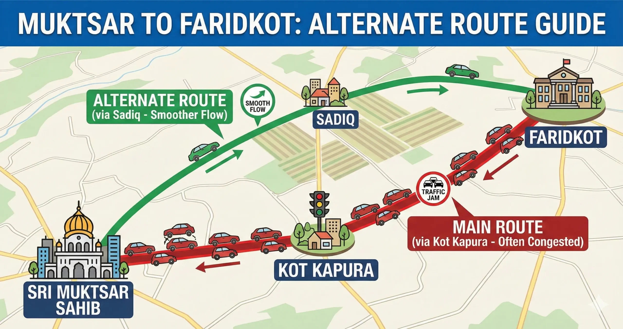
The journey between Sri Muktsar Sahib and Faridkot is a frequent commuter stretch of approximately 50–55 km. Students, patients, office workers, and transport vehicles regularly travel between these two important Punjab cities.
While most navigation systems suggest the highway via Kot Kapura, there is also a lesser-known but highly practical alternate route via Sadiq that helps avoid traffic congestion.
Here is a complete comparison of both routes.
The “Main Route”: Via Kot Kapura (The Standard Choice)
Best for: First-time visitors, nighttime travel, fog conditions, and access to roadside amenities.
This is the conventional, heavily commercialized route connecting the two districts.
Route Overview
Sri Muktsar Sahib → Bariwala → Kot Kapura → Faridkot
The Drive
- Exit Sri Muktsar Sahib heading northeast on SH 16 toward Kot Kapura.
- Pass through Bariwala town.
- Upon reaching Kot Kapura, merge onto NH 54.
- Continue north on NH 54 directly into Faridkot.
Distance & Time
- Distance: 52–55 km
- Travel Time: 1 hour to 1 hour 20 minutes (can increase during peak hours)
- Road Type: Wide State Highway + National Highway
Pros of the Kot Kapura Route
- Wide and well-marked roads
- Multiple petrol pumps and mechanic shops
- Plenty of dhabas and food outlets
- Safer for late-night travel due to regular traffic movement
- Better visibility support (lane reflectors) during winter fog
This route is ideal if you prefer highway driving with easy access to amenities.
Cons of the Kot Kapura Route
- Heavy congestion inside Kot Kapura city
- Railway crossing delays
- Slow truck traffic
- Can add 20–30 minutes during daytime rush
The biggest challenge is crossing Kot Kapura, where traffic from Bathinda, Moga, and Amritsar merges, creating bottlenecks.
The “Alternate Route”: Via Sadiq (The Smart Bypass)
Best for: Escaping traffic, predictable daytime travel, and a peaceful rural drive.
If you want to completely avoid Kot Kapura’s city congestion, the Sadiq Road offers a smoother alternative.
Route Overview
Sri Muktsar Sahib → Udekaran → Sadiq → Faridkot
Step-by-Step Directions
- From Sri Muktsar Sahib, take Sadiq Road heading north (avoid SH 16 toward Kot Kapura).
- Drive through Udekaran village and agricultural fields for around 30 km.
- Upon reaching Sadiq town, turn right (east) at the main chowk.
- Continue straight into Faridkot’s cantonment and university areas.
Distance & Time
- Distance: Approx. 50 km
- Travel Time: 1 hour to 1 hour 10 minutes
- Road Type: 2-lane undivided state highway
Pros of the Sadiq Route
- Completely bypasses Kot Kapura city
- No railway crossing delays
- Smooth rural traffic flow
- More predictable arrival time
- Calm and scenic surroundings
Cons of the Sadiq Route
- Narrower 2-lane road
- Fewer major fuel pumps and restaurants
- Lower visibility during dense winter fog
- Watch for tractors and village traffic
Quick Comparison Table
| Feature | Via Kot Kapura | Via Sadiq |
|---|---|---|
| Road Type | Highway (SH + NH) | 2-Lane State Road |
| Traffic | Heavy in city | Light rural flow |
| Railway Crossing | Yes | No |
| Amenities | Many | Limited |
| Best For | Night & Fog Travel | Daytime Fast Commute |
| Travel Predictability | Moderate | High |
Which Route Should You Take?
- If you are traveling at night, during heavy fog, or need frequent food/fuel stops — choose the Kot Kapura highway.
- If you want to avoid city congestion and reach faster during daytime hours — choose the Sadiq alternate route.
For most regular commuters, the Sadiq route offers a smoother and more reliable journey, while the Kot Kapura highway remains the traditional and fully serviced road connection.
Both routes connect the Malwa heartland efficiently — your choice depends on timing and travel priorities.
Questions Travellers Ask
1. What is the alternate route from Muktsar to Faridkot?
The best alternate route from Sri Muktsar Sahib to Faridkot is via Sadiq.
Route: Sri Muktsar Sahib → Udekaran → Sadiq → Faridkot.
This road bypasses Kot Kapura city traffic and railway crossings.
2. Which route is faster: Kot Kapura or Sadiq?
During daytime traffic, the Sadiq route is usually faster because it avoids city congestion.
At night or during heavy fog, the Kot Kapura highway may be safer and more comfortable due to wider roads and better lighting.
3. What is the total distance between Muktsar and Faridkot?
The distance is approximately 50–55 km, depending on the route taken.
4. Are there railway crossing delays on this route?
Yes, if you take the Kot Kapura highway, railway crossings near Kot Kapura can cause delays of 15–30 minutes.
The Sadiq route has no major railway crossing interruptions, making it more predictable.
5. Is the Sadiq route safe for night travel?
The Sadiq route is safe but is a 2-lane rural road with fewer roadside facilities. For late-night travel, many drivers prefer the Kot Kapura highway due to better amenities and regular traffic movement.
6. Which route has more petrol pumps and restaurants?
The Kot Kapura highway has more fuel stations, dhabas, and repair shops.
The Sadiq route has limited commercial stops.
7. Which route is better during winter fog?
During dense fog (December–January), the Kot Kapura route is generally better due to highway reflectors and continuous traffic flow that improves visibility guidance.
Travel Information Disclaimer
The travel information provided on this page is for general informational purposes only and may change without notice. Road conditions, travel times, fares, weather, transport availability, fuel access, and local regulations can vary due to traffic, maintenance, landslides, snowfall, or other unexpected events, so travelers should verify current details before departure. The publisher is not responsible for delays, losses, injuries, damages, or other issues arising from reliance on this information. Travel at your own risk and use appropriate caution, especially in mountain or remote areas.